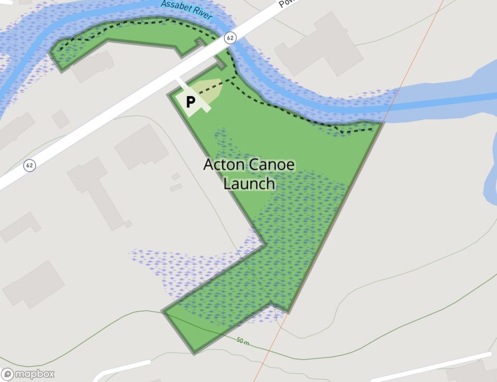
Location: 65 Powder Mill Rd. This is in far South Acton, on the south side of Rt 62, just west of the bridge over the Assabet River.
Acreage: Just a parking lot, a short path to the water, and a couple of hundred feet of fisherman’s path.
River Conditions: Safe for kayaking, too shallow for a canoe in the dry summer, fish are stocked twice a year.
Entrance: 65 Powder Mill Rd
“The river is an enchanter’s wand, ready to surprise you with life”
— Henry David Thoreau, August 8, 1859
Acton’s largest river, the Assabet, cuts through the southern corner of town then goes on to merge with the Sudbury river at egg rock to form the Concord river. Unique among Acton’s conservation parcels, the Acton Canoe Launch supplies a different escape from the constant bustle of the road above. Here you are not going to find the long yellow-blazed loop trail. Instead pause a moment and cool your hands in the water. The flowing surface and rippling sounds never stop. Popular with the fly fishermen, morning coffee drinker, kayaker, and mallard ducks.
This is the historical location of gun powder mills. You will notice that Acton, Concord, Sudbury and Maynard all have “Powder Mill Roads” leading here. You can still see remains of the buildings and railroads which formed this mill complex.
In 2004 Acton acquired a conservation easement on this parcel. This allows for a parking lot and a fisherman’s trail going both ways along the river. About 200 feet downstream from the river entrance the trail leaves Acton and the conservation easement. Please respect the private land in Concord as you would our public lands.
When parking your car, please first use the space on the right. You are welcome to drive into the meadow on the left when the parking fills up, or for unloading your boats.