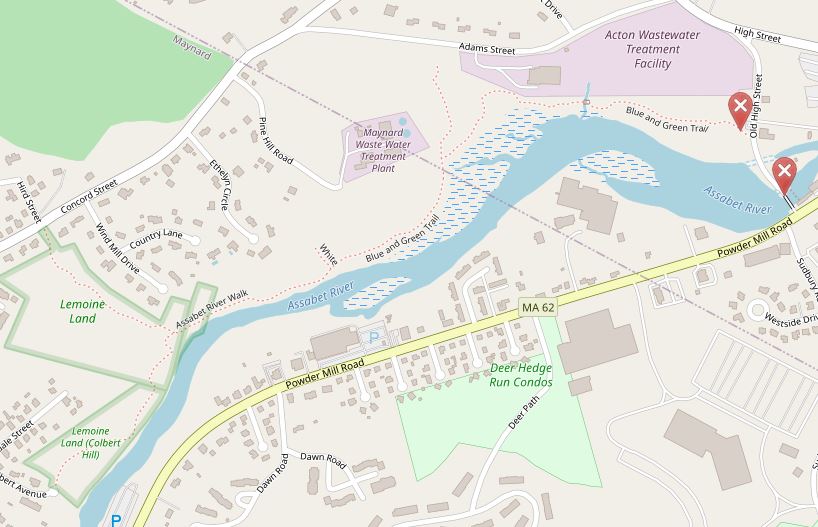
Assabet River Blue & Green Trail Map (pdf)
Out and Back Trail: 1.0 mile “out and back.”
Location: Across the Street from 308 Old High Street; small gravel parking lot. Old High Street is located near Adams Street, off High Street, in South Acton.
Trail: 1 mile along shoreline into Maynard, terminating at Colbert Ave., Maynard.
Acreage: 34.8 acres municipal property belonging to Town of Acton Department of Public Works.
Terrain/Trail Conditions: just upstream of historic Powdermill Dam, mostly level trail following river shoreline; 180’ boardwalk with observation platform and bench about 130’ from parking area, good for fishing, bird watching, relaxing. Trail continues for one mile across town line into Maynard, terminating at Colbert Ave.
Entrances:
- West side of Old High Street, across from 308 Old High Street, small gravel parking area.
- On Parker Street near intersection of Parker and Adams Streets, pedestrian only.
- Colbert Ave. cul-de-sac, Maynard.
In 2015 the Town of Acton Natural Resources Division and OARS for the Assabet, Concord and Sudbury Rivers (http://oars3rivers.org/) collaborated to write a $25,000 grant to the Massachusetts Recreational Trails Program to build a public blue (by water) and green (by land) trail. The purpose is to get more people recreating on local rivers. Part of the grant paid for a seasonal, accessible kayak launch installed and removed each spring and autumn at Ice House Dam in Maynard. In Acton, a 0.5 shoreline trail was constructed. The trail construction began in 2016 by volunteers and town staff https://maynard.wickedlocal.com/news/20160728/volunteers-clearing-path-along-assabet-river There are numerous wooden boardwalks and one bridge constructed by volunteers over muddy or stream crossings. There are numerous good fishing spots for those with valid Massachusetts Fishing Licenses. The trail crosses the Acton/Maynard town line at the Maynard wastewater treatment plant outfall pipe, where clean, treated water flows into the Assabet River. This is often a place to see great blue heron’s hunting for frogs. The trail proceeds another 0.5 miles until terminating at Colbert Ave. Much wildlife can be viewed along the river including bald eagles, various hawks, herons, assorted water fowl, beaver, muskrat, river otter, raccoon and deer. Ticks are most plentiful in April during October, so visitors should take precautions to safeguard health, such as wearing light colored clothing, spraying shoes and socks with bug spray, and doing a post hike (or bike) tick check. The trail is popular with mountain bikers. Though a trailhead and parking area have not yet been established on the Parker Street border of the property, there are numerous trails on this high embankment above the Assabet River. Also located along the south facing hillside, high above the river where the treatment plant is located, there was once a 7,000 year old Native American gathering place, renamed “Pine Hawk” by the discoverers in 2002. The archaeological site was properly excavated and catalogued. There is now a group called The Friends of Pine Hawk https://www.actonmemoriallibrary.org/resources-research/local-history/pine-hawk who are sponsored by the Acton Memorial Library. This group seeks to promote understanding of the archaeological and human story behind the great trove of Native American artifacts from the site, now recognized as one of the more significant Native American sites in New England. Every October the Friends of Pine Hawk sponsor a Fall Program series of events related to local archaeology and Native American topics. These events range from seminars and films to tours and family outings. The Friends also sponsor a year round Book Discussion Series, plan regular Community Service Events at the Trail Though Time in North Acton, and maintain a Speakers List. There is an educational information panel at the Old High Street trailhead, which discusses the historical significance of Powdermill Dam (currently privately owned http://www.concordconserves.org/acton-hydro-powdermill-dam ).